Hurricane Irma: An Unwelcome and Costly Visitor to South Florida and Key Biscayne
Key News ContributorJanuary 10, 2019
By Rumya Sundaram
Contributor
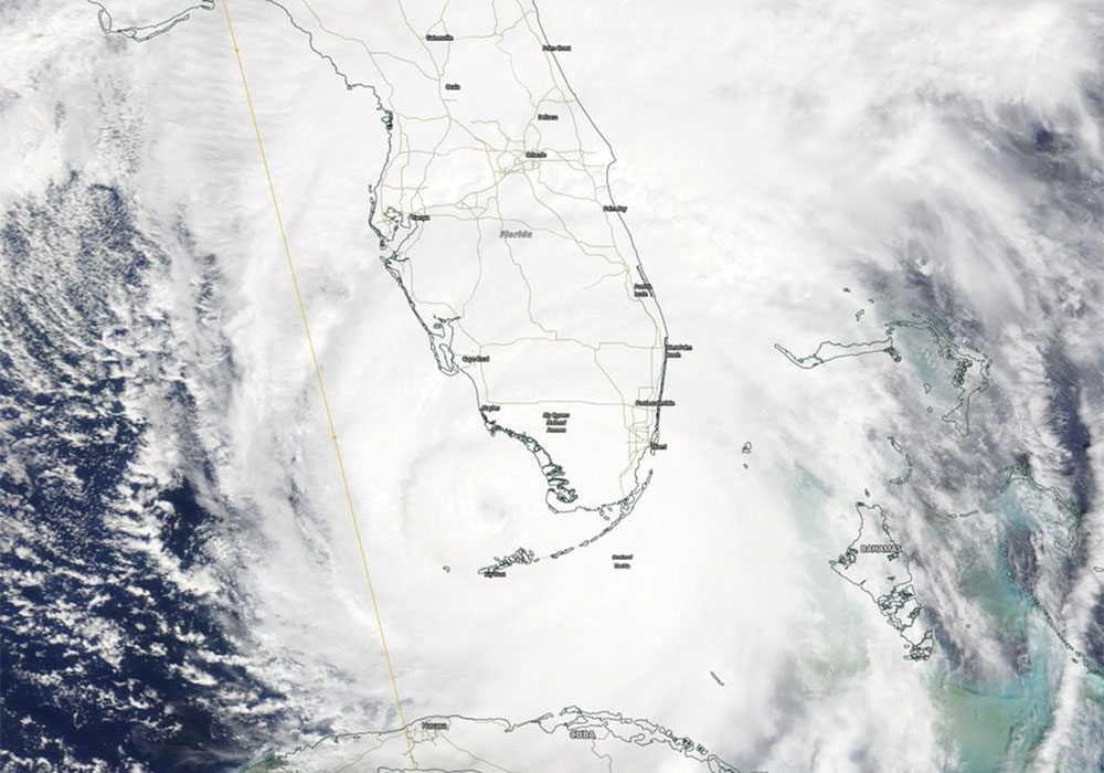
The trajectory of Hurricane Irma is shown on Figure 1. Irma was classified as a Cape Verde storm, forming to the south of these islands. Irma developed as it moved westward over the subtropical Atlantic and was a Category 4 storm when it made U.S. landfall on Cudjoe Key, Florida, which is located 20 miles east of Key West and 110 miles southwest of Miami. The locations of Cudjoe Key, Key West, and Miami are highlighted on Figure 2.
by Robert Molinari, Rumya Sundaram, and Melissa McCaughan White

Figure 1.The western portion of the track line of the eye of Hurricane Irma and two other hurricanes active in the region at the same time (Source: The National Weather Service).

Figure 2.Closer view of western portion of Hurricane Irma’s track through Florida, along with wind swath (Source: Weather.com)
We begin this article with a description of the Saffir-Simpson Scale (Table 1). The Scale provides a method to categorize hurricanes by wind speeds. A discussion of the oceanic and atmospheric conditions observed and predicted for the 2017 hurricane season follows. The costs of Irma damages to South Florida are then provided. The local costs of Irma to Key Biscayne, Florida is then given. Conclusions complete the article.
| Table 1. Saffir-Simpson Hurricane Scale (Source: www.nhc.noaa.gov) | ||
| Category | Sustained Winds | Types of Damage Due to Hurricane Winds |
| 1 | 74-95 mph
64-82 kt |
Very dangerous winds will produce some damage:
· Well-constructed homes could have damage to the roof, shingles, siding, and gutters. · Large branches of trees will snap and shallow rooted trees will be snapped or uprooted, blocking numerous roads. · Extensive damage to power lines and poles will likely result in power outages that last several days. |
| 2 | 96-110 mph
83-95 kt |
Extremely dangerous winds will cause extensive damage:
· Well-constructed homes could sustain major roof and siding damage. · Many shallower rooted trees will be snapped or uprooted and will block numerous roads. · Near-total power loss is expected with outages that could last from several days to weeks. |
| 3
(major storm) |
111-129 mph
96-112 kt |
Devastating damage will occur:
· Well-built framed homes may incur major damage or removal of roof decking and gable ends. · Many trees will be snapped or uprooted, blocking numerous roads. · Electricity and water will be unavailable for several days to weeks after the storm passes. |
| 4
(major storm) |
130-156 mph
113-136 kt |
Catastrophic damage will occur:
· Well-built framed homes can sustain severe damage with loss of most of the roof and/or some exterior walls. · Most trees will be snapped or uprooted and power lines will be downed. · Fallen trees and power poles will isolate residential areas. Power outage will last weeks to possibly months. · Most of the area will be uninhabitable for weeks to months. |
| 5
(major storm) |
157 mph or higher
137 kt or higher |
Catastrophic damage will occur:
· A high percentage of framed houses will be destroyed, with total roof failure and wall collapse. · Fallen trees and power poles will isolate residential areas. · Power outages will last for weeks to possibly months. · Most of the area will be uninhabitable for weeks to months. |
For non-specialists, the Scale also provides potential damages caused by a particular category storm.
ENVIROMENTAL CONDITIONS DURING 2017
The Main Development, MDR, is the area where storms form and develop. The location of the MDR is shown on Figure 3. Both observed and predicted 2017 environmental conditions were ideally suited to foster tropical storm development.

Figure 3. Expected vertical wind shear and SST patterns for the peak months of the 2017 hurricane season. Within the MDR, the red area indicates shear and SST patterns suitable for significant hurricane development (Source: NOAA).
Michaels et al. (2006) performed a statistical analysis of concurrent maximum sea-surface temperature (SST) values and concurrent maximum storm wind speeds. Their analysis indicates that maximum speeds (Category 3 or above) occur at SSTs greater than 28.20C (830F).
SSTs can be inferred from calibrated satellite imagery. Figure 4 illustrates SST inferred from data collected on 20 August 2017. SSTs from the western tropical Atlantic approach 300C (860F), suitable for growth of intense hurricanes as given by Michaels et al. (2006).
Vertical wind shear can be defined as the change in horizontal wind speed over a fixed height interval. Strong wind shear, i.e. increased wind with height, tends to hinder storm development. Weak wind shear has the opposite effect. The National Weather Service, noaa.nws.gov, generated a 2017 prediction of wind shear over the MDR. Shear values were suitable for hurricane development.

Figure 4.Satellite derived sea-surface temperature distributed for the North Atlantic Ocean. The data are for August 20th, 2017. White colored areas have no available data. The bar graph on the right indicates the temperature value (in °F and °C) of each color.
HURRICANE IRMA DAMAGES TO SOUTH FLORIDA
The Insurance Journal provided estimates of the damages to Florida caused by Irma. These damages are given here.
Damages (Figure 5) included,
- About 65% of homes and businesses were without power,
- The State Florida Catastrophic Fund estimated that it would provide about $5.1 billion in claims,
- Insurance companies expected $1.2 billion in insurance claims and 70,000 insurance claims, and
- More than ½ of the state’s orange crop was estimated to be lost.
HURRICANE IRMA DAMAGES TO KEY BISCAYNE, FLORIDA
Irma crossed South Florida as a Category 3 storm which had a significant impact on Key Biscayne, Florida. There was no loss of life associated with the storm’s passage, but costs to the Village were high. Overall, for damages, debris removal, and other Irma-related expenses, the costs to the Village totaled approximately $2.5 million.

Figure 5.Some of the effects of Hurricane Irma on Key Biscayne. (Photo credits: Top left, bottom left, bottom right: Paul Zuccarini; Top right: Christie and Sara Vila). Photos courtesy of The Islander News
CONCLUSION
South Florida will experience tropical disturbances in the future. Although the official hurricane season extends from June through November, an early tropical depression formed south of Puerto Rico during early May 2018. This weather system moved northward and resulted in significant rainfall over South Florida. In addition, a sub-tropical system developed in the eastern Gulf of Mexico, was named Alberto and made landfall along the U. S. Gulf Coast. These early examples of 2018 storm development argue for continuing preparedness and vigilance.
REFERENCES
Michaels P, Knappenberger PC, Davis. 2006. Sea-surface temperatures and tropical cyclones in the Atlantic. Geophysical Research Letters. https://Agupubs.onlinelibrary.wilwey.com/doi/full/10.1029/2006GL025757.
HURRICANE PREPAREDNESS
The 2018 hurricane season is upon us and not a moment too soon to begin prepping your home for what many forecasters project to be yet another intense storm season.
Key Biscayne, Virginia Key, Miami Beach, and all islands lying within Biscayne Bay are in Miami-Dade County Evacuation Zone A with the highest risk of flooding from storm surges. Miami-Dade County storm surge planning zones were redrawn in 2013 with updated data models. More than 1.75 million people are within one of Miami-Dade County’s five Storm Surge Planning Zones. To find out whether your home is within a storm surge planning zone, go to Miami-Dade County’s Emergency Evacuation webpage, click on the “Storm Surge Planning Zone Finder,” and enter your address.
TIPS AND INFORMATION
- Inspect your home for any area that might be susceptible to sustained high winds or heavy rains. County-approved storm shutters or 5/8-inch plywood are the most secure way to protect your windows and doors.
- Safeguard your valued electronics with a surge protector. Thunderstorms and high winds can potentially cause power outages or service interruptions. Power fluctuations from an electric current inrush will permanently damage electronics not designed to handle the additional voltage.
- Remove all loose or potentially dangerous outdoor items that can become a projectile during a storm. Tree pruning and coconut removal from palms greatly reduces storm debris.
- Creating supply kits including water, non-perishable food, medicine, personal products, and bedding
- Withdraw cash from the bank and fill gas for your vehicle, generator, and other gas-powered tools.
Miami-Dade County’s 311 Contact Center helps you stay connected as a tropical storm or hurricane approaches and provides important service information after the storm:
- Submit a service request at www.miamidade.gov/311direct
- Twitter:@MiamiDade311
- Call: 311 or 305-468-5900 (TTY: 711)
- Email:311@miamidade.gov
- Download the 311Direct App
DURING THE STORM
- Stay up to date with alerts on television, radio, or online.
- Stay indoors and away from windows. If possible, remain in a room with no windows until the storm subsides.
- If flooding threatens your home, shut down the electricity at the main breaker.
- Use flashlights – not candles or kerosene lamps – as your light source.
- If there is a power outage, unplug electrical devices and all major appliances.
- Keep children informed about what’s happening and watch for signs of stress.
AFTER THE STORM
- Remain indoors until local authorities say to go outside.
- Inspect your home for damage to assure it’s safe to stay there, and check for gas leaks.
- If you must go outside, beware fallen objects and downed electrical wires. Report downed power lines to Florida Power & Light.
- Stay out of areas with extensive damage.
- When clearing storm debris, use a broom instead of a hose to conserve water. Sweep and bag debris so it does not clog storm drains and cause sewage overflows.
- If your property is not near a public right-of-way, or if you live in a gated community, do not move debris to the nearest right-of-way until instructed by government officials.
CRUCIAL RESOURCES TO AID HURRICANE SEASON PREPARATIONS
Village of Key Biscayne
- Key Biscayne Hurricane Plan
- Key Biscayne Hurricane Information: Before, during, after the storm
- June 2018 CRS Newsletter #30
- Village Information Notification System: The Village of Key Biscayne emergency text messaging alert service
Miami-Dade County
- Miami-Dade County 2018 Guide to Hurricane Readiness
- Miami-Dade County Hurricane Guide
- Miami-Dade County Hurricane Preparedness Video
- Miami-Dade County Hurricane Preparedness Video (en Español)
- Miami-Dade County Emergency Alert Sign-up: Text and Email Alerts from the County
South Florida Regional
State
Federal
- NHS: National Hurricane Center “Be Ready”
- NWS: National Weather Service Hurricane Safety Tips and Resources
- FEMA: Federal Emergency Management Agency
To request the 2018 Official Hurricane Readiness Guide in an alternate format, call the Miami-Dade Office of Emergency Management at 305-468-5400.